Itchen Navigation: Survey of 1976
This page contains scanned copies of the pages from a survey of the Navigation carried out by members of the Southampton Canal Society and published by the Society in a duplicated booklet format in March 1977. The booklet was printed on both sides of ten sheets of foolscap paper which were folded in half and stapled together. About 950 copies were produced and sold for the princely sum of 30p.
The survey gives a picture of the condition of the Navigation nearly 50 years ago, together with a brief history of the waterway together with observations and recommendations which recorded impressions of the Itchen Navigation followed by reasons for restoration and possible ways in which these might be achieved.
At the time of this survey, the Departments of Transport and the Environment were proposing that the M3 should be built on the west side of St Catherines Hill and Twyford Down using the site of the Navigation between Tun Bridge and south of the Hockley Crossroads and some of the meadows to the west. The proposals included building a waterway west of the motorway to replace the length used by Winchester College as far as St Catherines Lock but culverting the remainder. It was not until later that the motorway route eventually built through Twyford Down was proposed.
The less controversial proposals for the construction of the M27 across the Navigation north of Mans Bridge were also in the air at this time but construction did not start until 1981. It was in 1979 that the Eastleigh Borough Council acquired the land that is now the Itchen Valley Country Park.
Please note that both the Southampton Canal Society and the Itchen Navigation Society referred to in the book are no longer in existence and the contact details are no longer valid.
All measurements are given in imperial units: miles (1.6 km), furlongs (201 m), yards (90 cm), feet (30 cm), inches (2.5 cm) - feet and inches may be abbreviated to ' and " respectively. Each page of the survey covers 4 furlongs (½ mile - 0.8 km).
The Itchen Navigation
Front cover of the booklet

The Itchen Navigation
Click on the picture above to start at the beginning of the booklet to include the Introduction, a map and a brief history.
The Itchen Navigation
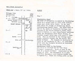
The Survey - page 1

The survey of the Navigation
Click on the picture above to go to the details of the survey of the Navigation from Winchester to Woodmill, Southampton.
The Itchen Navigation
Observations and recommendations - first page.

The Itchen Navigation
Click on the picture above to go to the Observations on and Recommendations for the Navigation.
The Itchen Navigation
Inside Front cover
The Itchen Navigation
Introduction
The Itchen Navigation
Map of the Navigation
The Itchen Navigation
A brief history
The Itchen Navigation
A brief history - second page.
The Itchen Navigation
A brief history - third page.
The Itchen Navigation
A brief history - fourth page.
The Itchen Navigation
A brief history - fifth and final page.
The Itchen Navigation
The survey - page 2.
The Itchen Navigation
The survey - page 3.
The Itchen Navigation
The survey - page 4.
The Itchen Navigation
The survey - page 5.
The Itchen Navigation
The survey - page 6.
The Itchen Navigation
The survey - page 7.
The Itchen Navigation
The survey - page 8.
The Itchen Navigation
The survey - page 9.
The Itchen Navigation
The survey - page 10.
The Itchen Navigation
The survey - page 11.
The Itchen Navigation
The survey - page 12.
The Itchen Navigation
The survey - page 13.
The Itchen Navigation
The survey - page 14.
The Itchen Navigation
The survey - page 15.
The Itchen Navigation
The survey - page 16.
The Itchen Navigation
The survey - page 17.
The Itchen Navigation
The survey - page 18.
The Itchen Navigation
The survey - page 19.
The Itchen Navigation
The survey - page 20.
The Itchen Navigation
The survey - page 21.
The Itchen Navigation
Observations and recommendations - second page.
The Itchen Navigation
Observations and recommendations - third page.
The Itchen Navigation
Observations and recommendations - fourth page.
The Itchen Navigation
Observations and recommendations - fifth page.
The Itchen Navigation
Observations and recommendations - sixth page.
The Itchen Navigation
Observations and recommendations - seventh page.
The Itchen Navigation
Observations and recommendations - final page.
The Itchen Navigation
Please observe the Country Code.
The Itchen Navigation
Back cover.